Devon · EX11
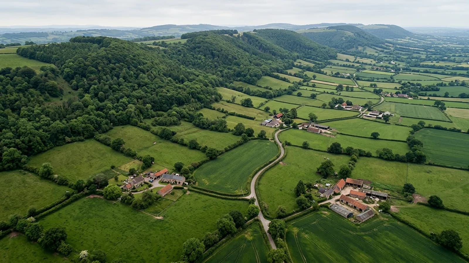
Drone survey in Ottery St Mary
A compact valley town with a great church, cob and thatch survivals in the lanes, and mist that lets moss establish on anything facing north.
Cob and thatch among the Georgian frontages
The centre around the church carries Georgian and Victorian frontages, and the lanes around it hold cob and thatch survivals, with post-war and modern estates spreading north and west. That mixture means two quite different survey conversations in one small town.
On a cob building the roof is doing structural work as well as keeping rain out, because cob relies on staying dry. A failed gutter or a slipped slate above a cob wall is a more serious matter than the same defect above a brick one, and the timescale for putting it right is shorter.
Damp air on the valley floor
The town sits in the Otter valley on gently rolling ground between the Blackdown Hills and the coast eight miles south. It is inland and reasonably sheltered, but the valley floor holds mist and damp, so moss and lichen establish quickly on shaded slopes and in valleys.
The practical version of that is simple: north-facing slopes here need looking at more often than south-facing ones, and the difference between the two on the same building can be striking in a photograph taken on the same morning.
The church and the buildings around it
St Mary's is a large and complex historic roof, and the buildings around it inherit some of the same conditions: tall stacks, deep valleys, lead work and an awkward relationship between old fabric and later repairs.
Flights near the church are planned rather than improvised, and any work of that kind is coordinated with whoever is responsible for the building. For domestic properties nearby the church simply provides a useful visual reference for orientation in the images.
A small town with easy ground
Ottery is comfortable to work in. Plots are reasonable, the ground is gentle, and there is farmland close by on every side. The Tumbling Weir and the water course through the town are features to keep clear of rather than obstacles.
Being inland, the weather window is wider here than on the coast, so a date is more likely to hold than one booked for Exmouth in the same week.
Cadhay, the lanes and the properties without a road
Around Ottery there are properties reached by lanes that will not take a large vehicle, and buildings like Cadhay House give an idea of the scale of some of the older houses in the surrounding countryside.
A single track lane is a genuine obstacle to conventional access. A scaffold lorry cannot get down it, a tower has to be carried, and the cost of reaching a roof at all can exceed the cost of whatever is wrong with it. An aircraft arrives in the boot of a car and takes off from a field gate.
That is the practical reason a rural EX11 address is often a better candidate for aerial survey than a house on a main road in the town centre, even though the town house is nearer and easier to find.
Behind the survey
What Ottery St Mary clients are actually buying
CAA registered
Registered with the Civil Aviation Authority as an operator, with both an Operator ID and a Flyer ID held. Anybody flying a camera drone for you should hold both.
A2 Certificate of Competency
The qualification that covers flying closer to buildings and to people than the basic rules allow. It is not a GVC and this site does not claim one.
Insured with Coverdrone
Commercial flights are covered by a Coverdrone policy. A copy of the certificate is available on request, and most managing agents will ask for it.
One named surveyor
Sam Hembury plans and flies every job himself and writes up every report. There is no crew and no subcontractor, so the person you speak to is the person who turns up.
DJI Mavic 4 Pro
A 100 megapixel Hasselblad camera and 6K video. That resolution is the reason a cracked mortar joint is readable in a photograph taken from twenty metres away.
DJI Mavic 2 Enterprise Advanced
Carries a 640 by 512 radiometric thermal camera alongside the ordinary one, which is a different job: heat and moisture rather than condition.
Report within 48 hours
The written report follows the flight within 48 hours. It is a process commitment rather than a promise about what the report will find.
Construction background
The reports are written by somebody who worked in construction before flying, so a defect is described in the words a builder or a roofer will use back to you.
Nearby
Also covered around Ottery St Mary
- HonitonA famously uniform Georgian high street rebuilt after fire, sitting in a valley that holds fog and keeps roofs damp right through the winter.
- SidmouthA Regency town in a steep valley where the hills either side gust hard around chimneys, on buildings with some of the most complicated roof geometry in Devon.
- CullomptonA Culm valley town on flat ground beside the M5, holding damp and frost, with medieval fabric, thatch and a lot of late twentieth century estate housing.
- ExeterThe city where the surveys are based, with a building stock that runs from Georgian terraces to last year's estates, and a river valley that keeps everything damp.
- CranbrookDevon's newest town, still building out phase by phase, where the survey questions are about workmanship and warranties rather than about age and wear.
See what it costs
Get a quote in Ottery St Mary
Send the address and what is worrying you. Sam Hembury will come back with a fixed price and the next slot that suits the weather.