Skip to content
Drone SurveyExeter · Devon and the South West

Exeter, Devon and the South West

What a drone survey is, what it shows, and what it costs

Most people reading this have been told they need one and have no idea what that means. So here is the plain version first. If it turns out you do need one, the price is fixed before anybody turns up.

  • One surveyor, Sam Hembury, who flies every job himself
  • CAA registered, A2 Certificate of Competency, insured with Coverdrone
  • Photographs you keep, and a written report you can hand to a builder
  • Covering Devon and the wider South West from Exeter

In one sentence

A drone survey is a set of photographs taken from the air of a building or a piece of land, and a written report that explains what those photographs show.
The report
Within 48 hours
The price
Fixed before the visit
Access
No scaffolding or ladders
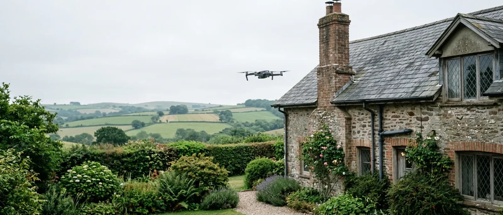
A small grey quadcopter hovering at ridge height beside a stone Devon cottage with a weathered slate roof and a tall chimney stack, garden and hedged farmland behind
A survey flight beside a slate roof in Devon. The aircraft works from the air, so nobody goes on the roof and nothing leans on the building.

Start here

Somebody has told you that you need a drone survey

It might have been an estate agent, a roofer who could not get up there, an insurer asking for evidence, a solicitor part way through a sale, or a neighbour who had one done. Whoever said it, they probably said it as though you already knew what it meant.

The short version is that a camera goes up on a small aircraft, takes a careful set of photographs of the parts of your building or your land that nobody can easily reach, and somebody writes down what those photographs show. That is the whole of it. There is no scanner, no x-ray and nothing that sees through a wall.

What that gets you is evidence. Instead of a roofer telling you there is a problem at the back of the chimney and you taking it on trust, you have a photograph of the back of the chimney, dated, that you can put in front of two more roofers and get comparable prices for. That is usually why people end up wanting one, even when they came to it for a different reason.

The three jobs

Three different things people mean by the phrase

The words cover a building being photographed, a piece of land being mapped, and a heat camera being flown over something. They are separate jobs with separate kit, and the right one depends on what you are trying to find out.
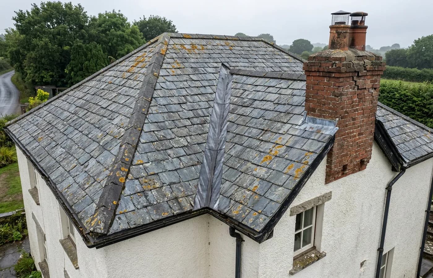
Aerial view of a rendered Devon house at a three quarter angle showing lichen spotted slates, a lead lined valley, a brick chimney stack with a cowl and black gutters

Building and roof survey

One building photographed from the air in detail, ridge to gutters, and written up so the condition of the parts nobody can reach is on the record.

Building and roof
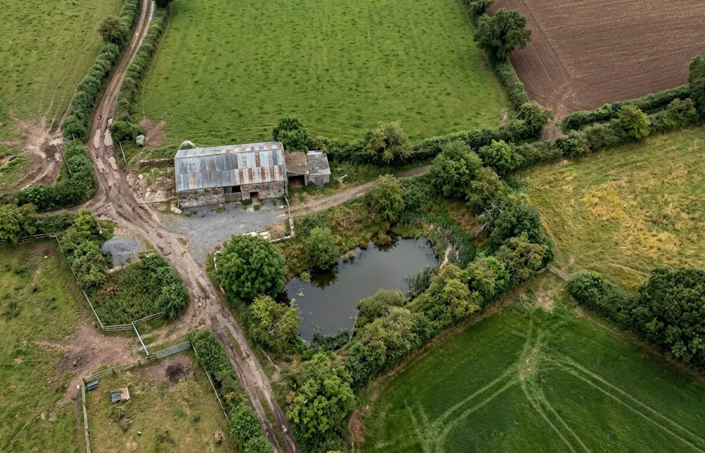
Aerial view looking straight down over Devon farmland showing hedged field boundaries, a farm track, a pond and a stone barn with a corrugated roof

Land and site survey

A field, a yard, a paddock or a development plot photographed from directly above and stitched into one flat image, so an area can be seen and shared.

Land and site
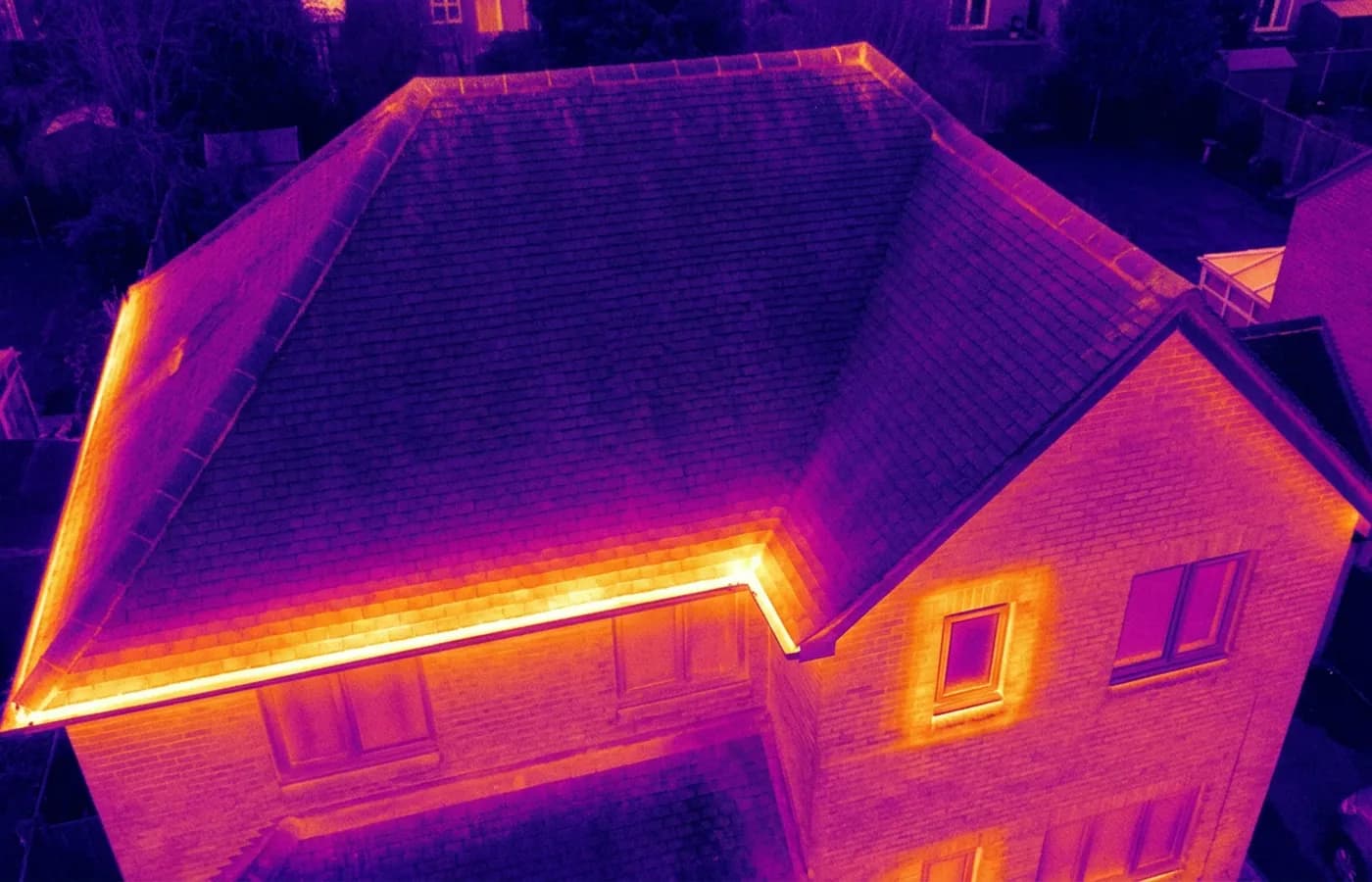
Radiometric thermal image of a house roof and upper elevation in ironbow false colour, with a warm band along the eaves and around a window

Thermal survey

A radiometric thermal camera flown over a building to show where heat is leaving it and where moisture is sitting, which an ordinary camera cannot show.

Thermal

Credentials

What sits behind the survey

CAA registered

Registered with the Civil Aviation Authority as an operator, with both an Operator ID and a Flyer ID held. Anybody flying a camera drone for you should hold both.

A2 Certificate of Competency

The qualification that covers flying closer to buildings and to people than the basic rules allow. It is not a GVC and this site does not claim one.

Insured with Coverdrone

Commercial flights are covered by a Coverdrone policy. A copy of the certificate is available on request, and most managing agents will ask for it.

One named surveyor

Sam Hembury plans and flies every job himself and writes up every report. There is no crew and no subcontractor, so the person you speak to is the person who turns up.

DJI Mavic 4 Pro

A 100 megapixel Hasselblad camera and 6K video. That resolution is the reason a cracked mortar joint is readable in a photograph taken from twenty metres away.

DJI Mavic 2 Enterprise Advanced

Carries a 640 by 512 radiometric thermal camera alongside the ordinary one, which is a different job: heat and moisture rather than condition.

Report within 48 hours

The written report follows the flight within 48 hours. It is a process commitment rather than a promise about what the report will find.

Construction background

The reports are written by somebody who worked in construction before flying, so a defect is described in the words a builder or a roofer will use back to you.

What you get
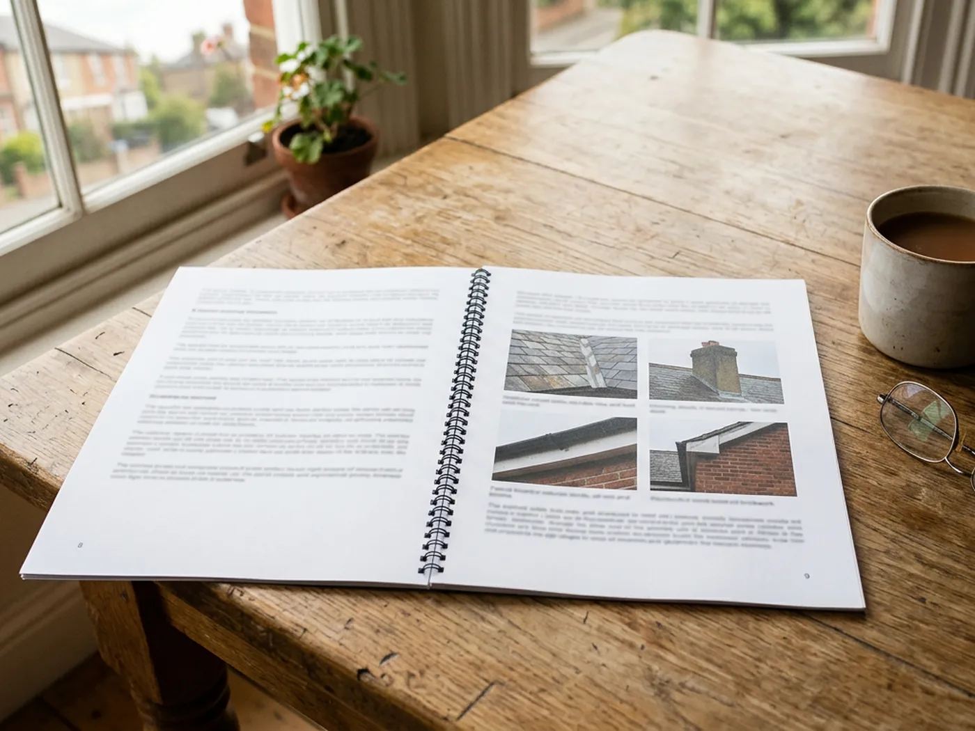
The report is the part you keep

The flight takes under an hour on most houses. The report is the slower half, and it is what you are actually paying for, because a folder of unexplained photographs is not much use to anybody.
  • A set of high resolution photographs of the areas that were flown
  • A caption on each one saying what it shows and where on the building it is
  • A written note of anything visible that looks worth attention
  • A plain statement of what could not be seen, and why
  • The original image files, so the record is yours rather than borrowed
  • Delivered within 48 hours of the flight, as a document you can forward
A printed survey report lying open on a kitchen table with photographs of a roof on the page, reading glasses and a mug beside it

What the camera sees

The level of detail a survey actually reaches

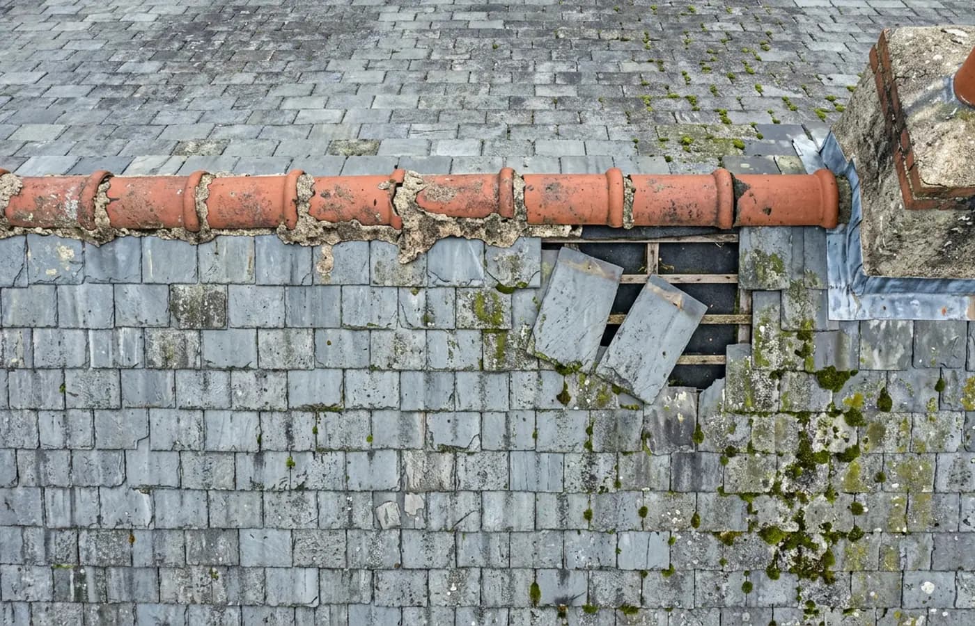
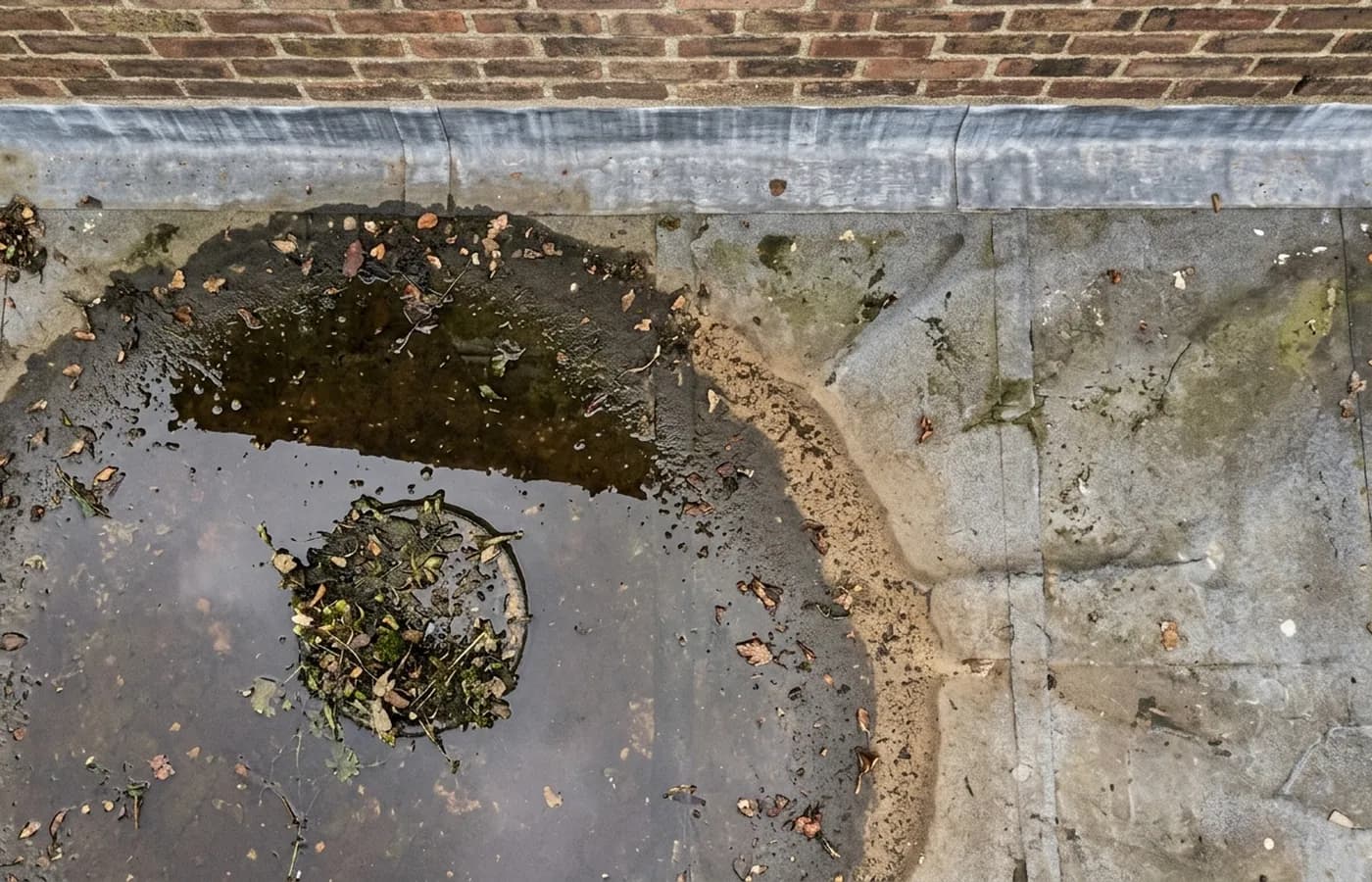
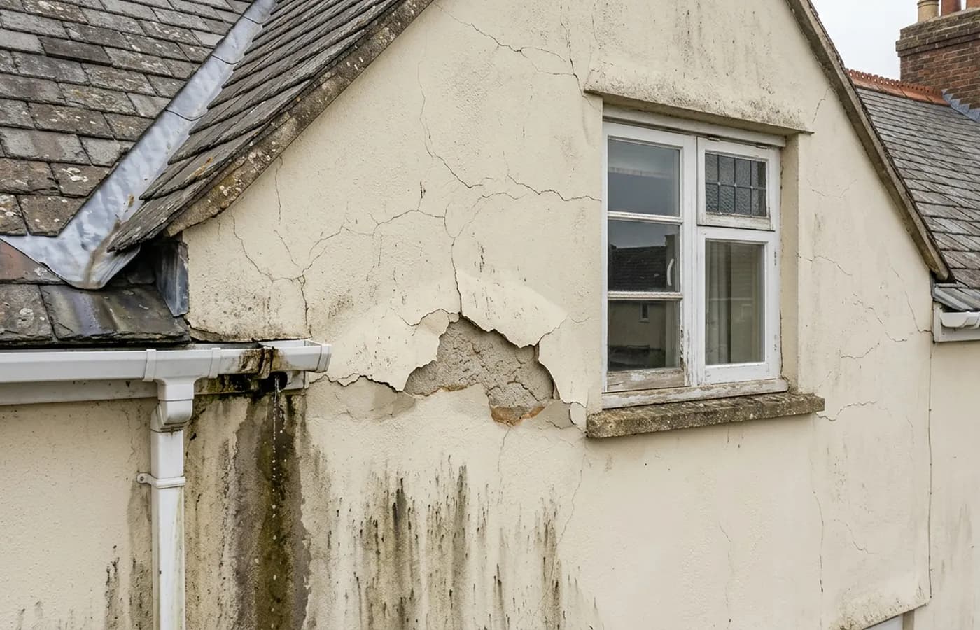
These are the kinds of things a flight records: a joint that has washed out, water sitting where it should be running away, a stain under a gutter. All of it from the air, none of it from a ladder.
Close aerial detail of a slate roof ridge with washed out mortar joints, slipped slates below it exposing the battens and underlay, moss across the laps and a stone chimney stack with lead flashing beside
A small flat roof photographed straight down with water ponding around a blocked outlet, silt and leaf litter across the covering and a flashing upstand against the wall behind
Aerial detail of a rendered upper elevation showing cracked render below a window cill and staining under a leaking gutter joint
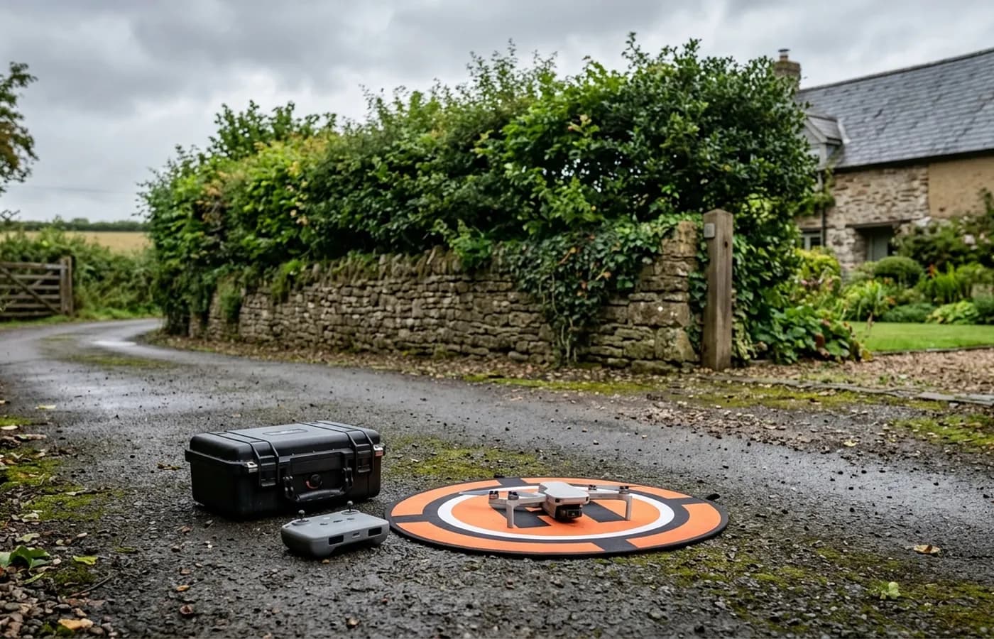
A drone on an orange landing mat on a farm track with two flight cases beside it, a hedgebank and a slate roofed building behind

Where we fly

Every town has its own page, not a list of names

Buildings in Salcombe have different problems to buildings in Cullompton, and the flying is different too. Each town below has a page written for that place.

Questions

Questions we get asked

What actually is a drone survey?
Photographs taken from the air of a building or a piece of land, plus a written report explaining what those photographs show. The aircraft carries a camera, not a scanner or an x-ray, so a survey records what is visible from outside.
Is it the same thing as a building survey?
No. A building survey is a surveyor walking through a property and forming an opinion on it, usually to a RICS format. A drone survey is a visual record of the outside, mainly the parts nobody can reach. The two answer different questions and are often used together.
How much does it cost?
A fixed price per survey, agreed before anyone travels, once the address and the job are known. Size, complexity and distance are what move it. There is a page on this site about what changes a price and why no figure is quoted before an address.
How long does the flight take?
A house usually takes under an hour on site including setting up and packing away. Larger buildings and land parcels take longer. The report is the slower half of the work, and it follows within 48 hours.
Do you need to come inside, or get on the roof?
No. Nothing leans on the building, nothing is walked on and there is no scaffolding or ladder. Most surveys need somebody to be there to open a gate and point out what is worrying them, and that is all.
What can a drone survey not see?
Anything under a covering, inside a wall or a roof void, below ground, or hidden by vegetation, standing water or snow. It shows the outside surface of things. Where something needs opening up to be understood, the report says so rather than guessing.
Do you need permission to fly over my property?
Flights are planned around the Civil Aviation Authority rules that apply, and around who and what is near the site. Some places need more planning than others, particularly close to an airport or in a busy town centre. That gets sorted before the visit is booked, not on the day.
What happens if the weather is wrong?
The flight moves. Wind, heavy rain and poor light all stop a survey, and rescheduling for weather costs nothing. Booking a firm date a fortnight out matters less than being available in the right week.
What do I actually get at the end?
A written report with the photographs in it, laid out so each image is captioned and explained, and the original files if you want them. It is yours to send to a roofer, a builder, an agent, an insurer or a solicitor.

See what it costs

Get a quote with Drone Survey

Tell us the address and what you need looking at. Sam Hembury will come back with a fixed price and the next available slot.

Call 07723 572149Get a quote